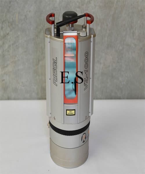
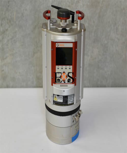
Riegl VZ-1000 3D Laser Scanner
Negotiable Min Order Quantity Unit
- Required Quantity
-
- Place of Origin
- Singapore
- Payment Terms
- Negotiable
- Production method
- Negotiable
- Shipping / Lead Time
- Negotiable / Negotiable
- Category
- Other Measuring & Gauging

equipsurveying ltd
- Verified Certificate
-
7

| Product name | Riegl VZ-1000 3D Laser Scanner | Certification | - |
|---|---|---|---|
| Category | Other Measuring & Gauging | Ingredients | - |
| Keyword | used 3d laser scanning surveying , used riegl vz-1000 | Unit Size | - |
| Brand name | - | Unit Weigh | - |
| origin | Singapore | Stock | - |
| Supply type | - | HS code | - |
Product Information
Condition : Demo unit, unopened and ready to work
Come with warranty 12 month
Included in Sale :
- Riegl VZ-1000 3D Scanner
- Flight case
- Vehicle/rack mount (vehicle not included)
- 3 x Rack Mount Screws
- Black External Battery
- External Battery Charger
- Battery Power Supply Cable
- 12v Power Supply Cable 1m
- 8 x Scanner Targets - Cylinder
- Blanking Cap
- Cap to 3/8 thread
- Cap to Thread Mount
The V-Line 3D Terrestrial Laser Scanner RIEGL VZ-1000 provides high speed, non-contact data acquisition for ranges more than 1400 m using a narrow infrared laser beam and a fast scanning mechanism. High-accuracy laser ranging is based upon RIEGL’s unique echo digitization and online waveform processing, which allows achieving superior measurement capability even under adverse atmospheric conditions and the evaluation of multiple target echoes. The line scanning mechanism is based upon a fast rotating multi-facet polygonal mirror, which provides fully linear, unidirectional and parallel scan lines.
The RIEGL VZ-1000 is a very compact and lightweight surveying instrument, mountable in any orientation and even under limited space conditions. It can also be mounted on a vehicle for stop and go scanning.
Main Features :
- Very long range more than 1400 m
- High speed data acquisition
- Wide field-of-view, controllable while scanning
- High-accuracy, high-precision ranging based on echo digitization and online waveform processing
- Multiple target capability
- Superior measurement capability in adverse atmospheric conditions
- High-precision mounting pads for optional digital camera
- Integrated inclination sensors, laser plummet, and compass
- Integrated GPS receiver with antenna
- Various interfaces (LAN, WLAN, USB 2.0)
- Internal data storage capability
Main Applications :
- Topography & Mining
- Archaeology & Cultural Heritage
- As-Built Surveying
- Monitoring
B2B Trade
| Price (FOB) | Negotiable | transportation | - |
|---|---|---|---|
| MOQ | Negotiable | Leadtime | Negotiable |
| Payment Options | Negotiable | Shipping time | Negotiable |

- President
- joni
- Address
- jalan Ong Kim Wee 75300 Melaka
- Product Category
- Other Measuring & Gauging
- Year Established
- 2015
- No. of Total Employees
- 1-50
- Company introduction
-
Our website contains a comprehensive range of surveying equipment products with best price offering, if you require any item not listed here please call or email us.<br>
We selling equipment to local and abroad customers, most of abroad customers come from across Asia, Middle East, Europe and South America continental.
Equip Surveying has established since 2013 in Jakarta.
We have helped many personal surveyor, company, government agencies and educational institution to providing surveying solutions.
Equip Surveying providing a wide range of new and used Surveying Equipment, 3D Scanner Scan Station, Detection Equipment, Electrical Testing Equipment, Fusion Splicers including Total Stations, GPS GNSS Surveying Systems, Digital / Automactic Levels, Laser Survey and Tripods with affordable price.
- Main Markets
-
 Canada
 Germany
 Hungary
 Ireland
 Russia
 Spain
Spain
 Switzerland
 U. Kingdom
 U.S.A
U.S.A
- Main Product
Related Products
GPS Data Logger for 3G Network
U-Prime (Environmental monitoring device)
Smart Geiger Counter for Smartphone with App Android iOS
Modbus Device Recorder
DIGITAL GAS METER


 Singapore


